

SF PhotoMap app for iPhone and iPad
Developer: San Francisco Public Utilities Commission
First release : 04 Dec 2014
App size: 7.02 Mb
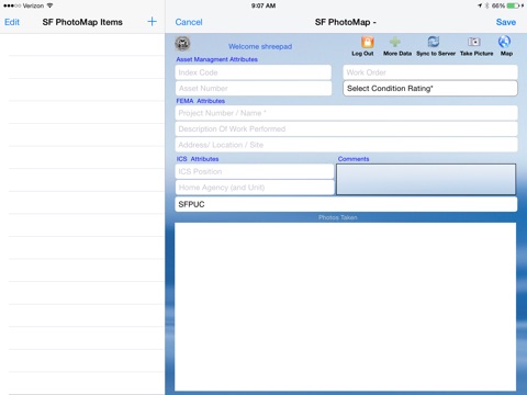
If you are a public or private entity and are preparing to document your assets, or have suffered from a disaster and need to assess your assets for cost recoveries, SF PhotoMap provides a simple and easy way to document and assess your assets which may be eligible for Federal, State, or Local agency cost recovery grants. The geo-tagged photos, their condition, documentation, and the ability to work offline
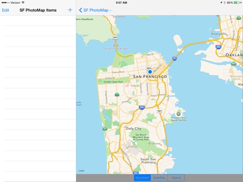
in the field allows for the rapid collection of data, presentation of documented photos on a GIS map, photos stored in a database,view photos from a browser, and update assets in your Asset Management system.
SF PhotoMap was developed by the City and County of San Francisco. It was used for condition assessment and cost recoveries to FEMA for the 2013 Rim Fire, and by the City of Vallejo for the 2014 Napa earthquake.
SF PhotoMap Features
Asset data and Photo collection for disaster preparedness and cost recovery
Geo tagged photos
GIS and Map integration
Integration with Asset Management Systems
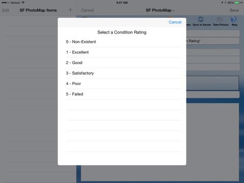
Asset condition assessments
Online or Offline capabilities
Photos may be used for FEMA grant for cost recovery
Cloud integration
View GIS / browser photos and documentation
Multiple photos per assets
Designed for the iPad
PDF Report
CSV file extraction
Photo Download
SF PhotoMap may be used by Federal, State, and Local agencies, or companies which may have assets that may be damaged or destroyed by a disaster, and the agencies and/or companies would be seeking Federal, State, or Local Grant cost recoveries.